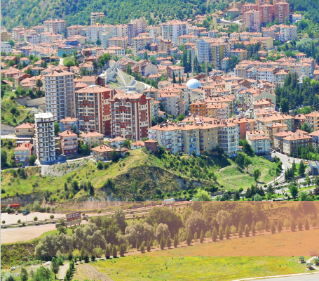
PhysIcal Structure
Kızılcahamam is located 57 km from Ankara.
Along with 105 villages on the E-5 highway
and one town, it has a population of 26.700
persons and is surrounded by forests making
it a beautiful corner. The population in the
center of the district is about 17.000 persons.
It is surrounded by Gerede and Çerkeş
districts in the north, Kazan and Ayaş in the
south, Çubuk in the east, Çamlıdere and
Güdül in the west.
Kızılcahamam is located in location of
changing zones Anatolia and the Black Sea.
Therefore, it has the characteristics and
vegetation of both zones. The highest places
of Ankara being Harami Hill (2053 m) and
Mount Işık (2030 m) are inside the borders of
the district.
Due to its horst and graben structure, it has
high mountains covered with pine and oak
forests, and the villages of Yemişen, Hıdırlar,
Miyala, Salın, Eldelek, Başköy and Yıldırım
which are located on the mountains, have
unique beautiful pastures and have many
little rivers as well. Kurtboğazı, Eyrekkaya
and Akyer dam in the district provide Ankara
with its drinking water.
Located 57 km to the north of the capital
Ankara, and being on the highway connecting
Ankara to Istanbul, and 1-hour drive away
from Esenboga Airport makes, makes
reaching our district very easy. Our district is
a touristic town located in a valley surrounded
by an evergreen ring of pine forests, making it
a place for resting and cooling in the summer,
and a forest covered with snow creating a
harmony of coloring rival to Switzerland’s
holiday resorts in the winter.
The healing waters that are in our
district have been used for that
purpose since the ancient times.
Patients seeking healing for many
illnesses, rheumatoid in particular,
come to the district especially in the
summer time and stay for 1-2 weeks.
Beside Büyük and Küçük spas managed
by the municipality of the district, Belediye
Kaplıca (spa) Hotel and the Soğuksu thermal
Hotel; the newly opened Patalya, Asya Tatil
köyü, Akasya Tatil Köyü, Şifa Hayat, Ab-ı
Hayat, Başak Termal, Deva Otel, Eda Otel
and otels similar to Çam Hotel, the spas of
Seyhamamı as well as the geothermals, all
provide healing to the patients through their
waters. Moreover, Kızılcahamam’s miner
water, which is considered the secondbest
mineral water in the world, is served
as odorless and pleasant mineral water
produced by Kızılcahamam mineral water
facility, as is known to be good for many
problems, especially digestion problems.
Nature TourIsm
With its unique and strange structure, our
district provides a tourism location suitable
for all kinds of tourism. In order to provide
a quiet and clean place for resting, sports,
hunting and having a good time with a
healthy spirit; Soğuksu Millî Parkı, Güvem
Karagöl location, Yıldırım, Işık, Karakiriş,
Hıdır mountains, Yemişen, Hıdırlar, Miyala,
Salın, Eldelek, Başköy villages and Yıldırım
pastures, as well as Zindan
well on Yıldırım Mountain
provide an natural beauty
worth seeing and perfect
possibilities regarding
wilderness tourism.
Recently, mountain tourism has been the
subject of much attention. Our locations are
ideal for nature tours, and have become the
first options for summer and winter tour
choices.
Moreover, the view of Kurtboğazı,
Bayındır, Eyrekkaya and Akyer
dams, as well as Üçbaş, Kurumcu,
Karacaören, Kırköy, Pazar, Çeştepe
villages provide an unique and
natural beauty.
Soğuksu Milli Parkı, which provides
an “Emerald” green color, has a
natural richness with its unique
structure that stands against
distortion, hiding its beauties and
has a different view each season, a
beauty that makes humans silent.
According to the studies carried
out up to date, there are wild boars, bears,
foxes, coyotes, squirrels, rabbits and similar
animals, as well as about 200 different types
of birds. You can also see all types of raptors
of our country in this area. Even species that
can be seen rarely in Turkey are seen there,
such as steppe eagle and other
raptors ranging from Bozkir
Eagle, falcons as well as, red
falcons, , booted eagles, Egyptian
vulture, the black vulture, lesser
kestrels and owls.
All kinds of wild animals can
be seen in our district. In
particular, rabbits, foxes, wolves
and pigs can be almost everywhere. Due to
the presence of bushes, stones and water
resources, you can find partridges near
Çeltikçi and Pazar.
In addition to these, one can find otters and
bears in Kirmir Valley, and one can find
lynxes in Avdan and Kızılcaören’s pastures
and forests and one can possible to see deer
in Mount Işık.
As for the dams, one can go fishing for
Leuciscus cephalus, black fish, carp, Israeli
carp, pike and sea bass.
Health (Thermal) Tourism
Kızılcahamam spa water is known to be
managed in the time of the Romans and
Seljuks for rheumatic diseases, kidney and
urinary tract diseases, digestive system
diseases, gynecological diseases and
bone and joint disorders. Moreover, our
mineral water is good for the stomach, liver,
cardiovascular system, bronchitis, and is
useful in the treatment of heart diseases, as
well as physical and psychological illnesses.
Due to the fact that our district has
been known as a center for spas
since ancient times, many guests visit it,
especially during the summer. This need is
met by private hotels, municipality’s thermal
hotels, and 10 touristic facilities with a
capacity of 6635 beds with many stars.
The Characteristics of the
Thermal Water in Our Spas
the spa water used in Kızılcahamam
municipality facilities contain 2748 mg/ lt of
minerals.
our spa water; thermomineral water that
contains sodium chloride, bicarbonate and
fluoride.
Our spa water has the
characteristics of healing the
following illnesses
1-Joint illnesses related to Arthritis.
(Osteoarthritis, Osteortroz)
2-Inflammatory rheumatic diseases.
(Ankylosing sipondilit, Romaloid Arthritis)
3-Neck, shoulder, back, waist and other joint
pain.
4-Spine diseases.
5-Neck and herniated disc pain.
6-Sciatica.
7- Soft tissue rheumatism. (Fibro-Miyalji
syndrome, other muscle aches)
8- Sports injuries.
9- Stress Disorder.
10-Nörovegatatif dystonia.
Cultural TourIsm
The area many remains that enriches cultural
tourism in our district starting from the spa
building dating the Romans era, as well as;
Martyrs Tree (Şehitler ağacı), caves of of Alicin
Kanyon (Alicin kanyonu kilise mağaraları),
Ağsar Castle (Ağsar Kalesi), Taşlıca Köyü
Oruç Gazi, Kyrgyz Ebe Shrine, the Bride
Rock (Gelin Kayası), the Church Caves of
Court Tree (Mahkeme Ağacin Köyü kilise
mağaraları), Abacı Fairy Chimneys (Abacı
peribacaları), Güvem basalt columns (Güvem
bazalt sütunları), herbal and animal fossils
of Beşkonak Village, Yunus Dede Shrine in
Kızılcaören village, Mehmet Dede Shrine in
Çeştepe village, Başköy Castle, Lightning
Dungeons’ forests and Seljuk mosque in
Pazar village with traces that belong to the
past.
Of these riches, Alicin Monaster, the caves
of Court Tree, Abacı Fairy Chimneys, Güvem
basalt columns, fossil layers of Beşkonak,
and Karagöl were encompassed by Jeopark
projects, and thus became open for tourism.
In addition to this, many touristic cultural and
art events are organized in our district every
summer. This cultural and art events last
one week and attract hundreds of thousand
visitors.
In addition, our district, a major tourist
organization, the culture of the environment,
art house with the water festival every
summer, a week-long arts and cultural events
hosted within the scope of the hundreds of
thousands of visitors. Due to the richness of
our district with historical traces and ruins, it
has attracted more attention in recent years.
Beside its historical riches, there is an effort
to develop the language, clothes, handcrafts,
local music and games.
PLACES TO WORTH VISITING IN
KIZILCAHAMAM
1- Soğuksu National Park
Soğuksu , which is one of the most natural beauties,
became a national park in 1959, is located 1 km
away from the center of the district.
The national park, which is affiliated with the
Ministry of Forests, has 16-km-long highway,
places for camping, mountain tourism, mountain
climbing, hiking, and places suitable to be used for
cross-country trails.
Black Vulture
Our district is considered the biggest colony in Turkey
for the black vulture, whose number is declining
rapidly in many regions in Europe and is considered an
endangered species.
A project carried out by the Ministry of Forests and
supported by the United Nations, worked on identifying
the factors that endanger the colonies of the black
vulture, and aimed at preserving its population by
eliminating these factors. In 2009, a facility to watch
the black vulture was established on the back of the
national park and was opened to the visitors.
Flora
Regarding the flora, the national park is considered
very rich. Starting from 1100 m, larch, pine, fir,
juniper, oak, poplar, willow, beech, maple, dogwood,
black locust, hawthorn, common blackberry, gorse,
wild pear, mistletoe and Labiatae can be seen there.
Moreover, several types of meadow grasses (usually
alfalfa), as well as thyme with flowers, wild berries,
wild rose, and wild plant species such as nuts are also
available in abundance.
Ataturk’s Pine
This is where Ataturk rested when he visited Soğuksu
Milli Parkı in 1934 during his visit to our district. This
is considered one of the important locations not only
due to its historical importance, but also due to the
surrounding beautiful nature in the national park.
b) Wild Life
In the square of the park, one can see different types
of animals; such as wild boars, bears, foxes, coyotes,
squirrels, rabbits and similar animals, as well as about
200 different types of birds. You can also see all types
of raptors of our country in this area. Even species that
can be seen rarely in Turkey are seen there, such as
steppe eagle and other raptors ranging from Bozkir
Eagle, falcons as well as, red falcons, , booted eagles,
Egyptian vulture, the black vulture, lesser kestrels and
owls.
2- Traditional Bath
The bath that is commonly known by the people as
“Roman Bath” is located space near Büyük Kaplıca.
While it body has the shape of a lying cylinder, a
large wall was built in the center entry after the
announcement of the Republic. Before, it consisted of
seven sections connected to each other, yet only three
sections are standing today. As for the other sections,
they were destroyed during the building stage of the
spa facility. The low-arched door and the entrance of
the first section are higher than the others, this used
to be the changing room. there is a small door directly
to right from here, it leads to the place of the bath.
There are two small sections here, one was used as a
pool, the other as bathing place.
3- Kızılcahamam house
It is located in the center of the district on
Kazımkarabekir Street, just opposite the teacher’
lodge, right on a small hill. It was constructed in 1925.
At the time, it was constructed as a typical wooden
district house; the first floor had only one section
above one room. Loosing much of its original structure,
the corrugated tiles were replaced by Marseille tiles.
The basement is entered by small steps; there are two
rooms, one on the left, and one on the right. Of these,
one is used as a kitchen with a cooker, used for dinning
and daily living, and the other is used for guests or a
bedroom. There is a wide space between the rooms.
Further to the front, there is a section used a toilet
and a sink. Using the stairs to get out of there, one can
move to the room upstairs. It is said that this room
used to be used as storage pantry back in the days
when there were no fridges.
4- Taşlıca Village
a) Kırmızı Ebe Shrine
During the Anatolia Seljuks time, the ruler Alaaddin
Keykubat visits Taşlıca village on his way when he is on
the conquest for Başköy castle. Here, Kırmızı Ebe and
his son, Oruç, meet the Turkish soldiers and provide
Ayran to them. He pours the Ayran into a groove and
asks all soldier to fill their drinking vessels with Ayran.
After all the soldiers have drunk Ayran and filled
their drinking vessels, the Ayran in the groove was
still there. This miracle was possible to be true as the
public had known Kırmızı Ebe to be a saint.
b) Ayran’s Stone
The stone trough (Ayran Stone); is located in the
cemetery above Taşlıca village. During the restoration
of the shrine in 2001, this trough was put in a cage, and
an inscription describing the above event was erected
next to it. All visitors who come, do not leave without
seeing the Shrine, the Bride Rock and this Stone, they
make their wishes; that is why they bind cloth to the
nearby branches of hawthorn tree.
c-Oruç Gazi’s Shrine
The shrine of Oruç Gazi, the son of Kırmızı Ebe, is
located in the lower cemetery to the south of the
village. There, one can see three other tombs which
are believed to be for family members of Oruç Gazi.
The ruined tomb was restored to the Seljuk style in
2001.
d) Bride Rock
on a hill to the south of the village, appears a real
bride-on-a-horse-like shape. Nearby, one can find
the brides trivet, her room, stairs as well as stones
shaped like drums that makes the drum-like sounds
when struck with stones. It is said that these were the
bride’s drums. The habit of playing drums at weddings
is said to be one of the Byzantine’s ways of expressing
excessive entertainment. Residents of Taşlıca still
carry on this habit of drum playing up to this date.
It is said that residents of nearby villages who did
not believe the story and played these drums were
paralyzed and had to stay in bed.
5-Kızılcaören Village
a) Yunus Dede Shrine
It is located 5 km away from the district on the way
connecting Anakara to Bolu (D-750). Yunus Dede is a
student and a disciple of Şeyh Ali Semerkandî. After
finishing his schooling, the Seyh send each of his
students on tasks to certain destinations. When the
turn comes to Yunus Dede, there is no destination left
to be assigned to. When the Seyh sees the sadness
of Yunus Dede, he grants him a bundle in order to
satisfy him. Yunus Dede takes the bundle and walks and
walks until he reaches his meadows of his own village,
Kızılcaören. He becomes curious as to what was inside
the bundle. A flying knife comes out of the bundle and
strikes the log of the oak tree next to the shrine. When
Yunus Dede dies after some time, he is buried in his
own village of Kızılcaören, under the same tree too.
According the story, visitors of Çamlıdere Şeyh Ali
shrine, first visit Yunus Dede and then visit the shrine
in Bardakçılar.
b) Gökdere
It continues along the valley starting from the village’s
cemetery for 10 km. It is a perfect place for resting
and picnics, and has an abundant drinking water. At
the crossroad after 6 km, there is a sarcophagus
believed to be dated to the Roman era located on a hill
(Kaya Mezar). However, it is destroyed. Using the same
highway, the National Park , Mount Çamlıdere Alıç
and the dark green meadows of Kızılcaören village can
be reached.
6- Caves of İğmir Village
İğmir village is located 4 km up above Pazar village;
one can find many caves in its rocky area. One of these
is said to be extending up to Otacı village which is 5 km
away, with unknown length.
As for the other caves, they are ingraved in the rocks
with open fronts, as are shaped as large hangars.
Some of these are used by the local residents as
stables nowadays. Although it is not known to which
era these caves go back, it is thought that they belong
to the Roman-Byzantine civilizations.
7- The Church Caves of Court Tree
The village of Court Tree (Mahkeme Ağacin Köyü) is
located 18 km away from the center of the district,
and is an old residential place on the way to Çeltikçi.
Some of the designs and type of usage still shows
belongingness to Christianity.
Besides these, one can find caves used as residents,
storage and for win production. There is a probability
that the residents of these caves were the first
Christians that lived in hiding from the wrath of Rome.
Since the soil on the ground of the caves is a bit wet
and loose, it means that it has been turned easily to
homes and churches.
Inside the churches of Kaya, there are niches where
crosses are positioned. The three downhills of
Kadıpınarı are dominated by an artificial plateau. This
plateau, which extends over 8-10 acres, has caves on
its end 5 m high.
The structure of the plateau and the outer shape of the
cave shown that there was no more need for hiding.
The plateau may have been used for religious meeting
and preaching.
8- Abacı Fairy Chimneys
It is located 20 km away from the district, on Çeltikçi
road just over the crossroad of Başören village. The
original block is a product of “Natural Art” dating to 11
-16 million years ago (Middle Miocene)-year-old tuff.
The formation of Fairy Chimneys dates approximately
back to the last hundred thousand years, and they are
considered the second most beautiful fairy chimneys
after Ürgüp’s.5 acres of land at the entrance of Abaci
neighborhood, is where the Fairy Chimneys from 11-
16 million year-old tuff. These are the products of
corrosion-based ‘Natural Art’.
They are formed during the last hundred thousand
years and are considered the second most beautiful
fairy chimneys after Ürgüp–Göreme in Anatolia.
The legendary Fairy Chimneys located at the entrance
of Abaci neighborhood of Çeltikçi Başören village, is
also an obvious evidence of the widening of Kirman
valley.
9- Abdülcemil’s Shrine in Üçbaş Village
Üçbaş Village is 10 km away from our district. It can
be reached through the road diverting at the Pırnak
Traffic Police Station, when using the road coming
from Kargasekmez.
The shrine, which is located in the east of the village,
was in a ruinous and destroyed state in 2007. It was
then restored by an initiative of the village’s headman
and association, with support of the Special District
Administration. It is located 500 m away from village
on the old Taşlıca road, inside the smallest of three
cemeteries on that road. Abdülcemil nibs, being
theson of Kırmızı Ebe and the brother of Oruç Gazi, is
believed to have settled in Üçbaş and have struggled
and lived among the people as told in the story.
10- Hambar Rock
The height of the rock, which is located opposite
Yıldırım Hacılar Village, is 50 m. It has the length of 200
m. It is located in a dominant position in comparison
to the nearby lands. According to the legend, there
was a hole in the upper part of the rock, but not there
anymore, which is used by one archeologist to get in.
There he found old clothes; such as, socks, trousers
and underwear. It is said that it is impossible to get
in now.The rock is believed to be used as a shelter
during the Romans-Byzantine era. Later, the rock is
said to be used by outlaw as a place of refuge. Right
at the outskirt of the rock, there is a water source for
shepherds.
11- Saray Village Bazaar
Saray village is located 8 km away from the district,
right on the old road of Güvem. There are ruins of
building built with bricks dating to the Romans era
in the village. Entering the building blocks is made
possible by using the arched doors, each door leading
to a different compartment. Saray (meaning palace in
Turkish), is said to be named after what the ruins were
once. The divisions inside the ruins are used by the
public as places for storing barn.
The space in here was used as a marketplace. Just
opposite it, you can find the bazaar and shops dating
to the Medieval Byzantine. Threshold stones with
straight design are used in the floor of the homes
and on the walls, but stones with half-man half-horse
figure are used on the north walls of the homes.
12-Alicin cAnYon:
a) The Caves
Alicin River is located at the exit of Çamlıdere dam,
on the E-89 highway. There are many caves on the old
road of Kalemler village, with depth of (140 m) and
next to a very steep valley, they are 70 m higher than
the ground level. It is believed that they were populated
around the second half of the 19’Th century.
Even though it’s said that Cin Ali (Genie Ali), one
famous outlaw, it probably dates back to the Romans
era, to be used as a security location; which makes
more sense.
Nowadays, it is only possible for professional
mountaineers to climb the castle and see the beautiful
surroundings it offers. At the bottom of the valley,
there is the Soğulcuönü fountain; this area can be
used as a place for picnics.
This structure, that is known to be a Monastery, has
been built in style similar to Sümela in Trabzon, yet
there are no signs of any religious or social symbols
b) Ağsar Castle
Ağsar castle creates a right angle with Alicin Caves;
it is located on a steep positon between Kurumcu and
Çamlıdere dam. It is about 300 m high between the
mouth of the dam and Kısıkkaya. The castle which is
located on the top of the rock in not known to which
era it belongs. But the shape of the walls looks like
that it belongs to the Phrygian period.
The peak just before where Ağsar castle is located,
and is known to be the Muslim castle by the residents
of the northern slope. The four walls are crudely
woven in a primitive manner. The building has an area
of about 100 square meters, it can also be referred to
as a “dairy”, but the people still refer to it as a castle,
which means that it used to be for the security of the
road during the Ottoman Empire. It should be one of
so-called “Derbent” outposts.
13- Seyhamamı
Seyhamamı spas are located 18 km from
Kızılcahamam, 3 km away from Güvem. It is said that
they were established by the German armies during
the Crusades. The village was known before as Kilise
(church), the old church as demolished during the
Iskender Bey time of the Candaroğlus (the second
half of the 15’th century); a mosque was built in the
same location. Although the mosque was restored
many times in the past, it was restored by the General
Directorate of Foundations in 2007 in a similar way
as its original shape. The Ottoman scholar Ali Cevad,
from Syhamamı refers to it as “Sek Hamamı”.
14-Karagöl
Karagöl is located 35 km away from the district; it
can be reach by the Güvem- Belpınar road. The lake
is surrounded by hills covered with pine trees, as is
extended over a wide plateau. Although there are no
facilities there at all, the season is remarked with many
visitors. There is no fish in the lake. There are plenty
of leeches and water turtles, in addition to this; it is a
quiet place for ducks to breed. Swimming is the lake
can be dangerous because the lake is shallow in some
places but become deep suddenly. The environment of
the lake is a very nice place of daily visits as well as
camping.
15- Başköy castle
Başköy is located 35 km away from the district. It is
also located 10 km from the castle of the village. The
walls of the castle are ruined with heights of 1.5-
2 m. As for the caves, they are located 300 m below
the castle. Theses caves that have engraved from a
volcanic mass, are believed to be used in the Ottoman
era for security purposes.
It is possible to observe a fantastic sunset if visited at
the end of the day.
16- Eldelek
It can be reached by a road different from Karagöl.
It has exquisite highland forests among wide plains.
After these plains, the trees become cedar and
fir trees. After this section, a nice plain location is
available for camping. During the Ottoman time, this
area was used to breed eagles and falcons for the
palace. It has and exquisite beauty with its rocky
heights. One of the most important features here is
the Emekli Peak, which is 1800 m high. It is almost
possible to reach the top with vehicles. It is an
interesting place for climbing enthusiasts. It is said
by the local residents that one sportsman climbed the
mountain a long time ago, when he reached the top, he
did not see what he expected. He lamented and said
“OH my dear efforts!”- Emek means effort-, and thus
the name came along.
17- Basalt Columns
(Soap Rocks)
They are located near Fındıklı neighborhood on
Güvem-Çerkeş road, they are position bordered by
rocks on both sides near the strait.
The basalt dates back to the “Third Period” (the
Tertiary, 20-25 million years ago). It was formed by
volcanic eruptions in the shape of a hexagonal prism,
when the magma, poor in silica but rich in magnesium
and iron, appeared on the surface.
Some lava flows that touched the lower surface cool
rapidly and solidified as an amorphous slag. The lava
between these two slag crusts cools down slowly and
shrinks after a while. Due to this shrinking, stress is
created and many vertical cracks come along. These
cracks push the prism to the surface. The more
homogeneous the lava mass is, the smoother the
cracks of the prisms.
Due to their soap bar-like shapes, it is known by the
locals as “soap rocks”. The basalt columns have been
visited by many in recent years.
18- Fossil Layers of Beşkonak
The fossils found in basin of Beşkonak village in our
district go back to microscopic plants and animals
that lived in sweet, salty lakes and see water. When
these organisms died, their shells precipitated and
separated from their organic structures and that were
destroyed, behind it, were the accumulated large
amount of shells of organisms forming “Diatomite”
layers. During inspection, it was found that Aköz,
Gürcüler, Salın and Kerimler are rich in these layers.
Fossil levels in Miocene, old flora and Fauna can be
seen inside sediments and generally in the slopes of
the valley, as well as at the edges of the lake. These are
the collection of the fossils of the fauna of the lake;
fish, frogs, reptiles, insects as well as flora of; leaves,
stalks and seeds.
19- Baba Kıbel Shrine and Tumulus in
Çeştepe
There is an old location know and upper Çeştepe,
located 2 km away from Çeştepe village; it is believed
to be and old settlement. Baba Kıbel opened an
accommodation and passengers lodge during the
classical ear of the Ottoman Empire. His shrine is
located today near ruins called Karvansaray by the
locals. An open-top ruinous structure in a cemetery is
said to be Baba Kıbel Shrine, it is installed on the wall.
At the entrance of the mosque just near cemetery;
there is a column head dating to the Romans era on
the left, as well as marble stones with Ottoman writing
inscribed on the right.
Çeştepe village has also a 30-meter high tumulus
which dates back to the ancient times.
20- Seljuk Mosque in Pazar Village
Although it was a church during the Romans era, it
was turned into a mosque in Seljuk’s time. The doors
and windows of the building were later reorganized.
Meanwhile, stones with outstanding figures on were
used in the walls.
Leave a Reply